
The key to consistently finding summer bass is reading a topographic map not as a simple chart, but as a behavioral blueprint that predicts where fish will be and why.
- Structure like drop-offs and points are not just locations; they are highways and ambush points that bass use daily.
- Water temperature, specifically the thermocline, creates an invisible “floor” that dictates bass depth and location.
Recommendation: Before your next trip, spend 30 minutes cross-referencing your map with these principles to identify three high-percentage spots. This preparation is more valuable than hours of random casting.
Staring at a vast, shimmering lake on a hot summer day can be intimidating. You know the bass are in there, but where do you even start? Many anglers fall into the trap of randomly casting at visible cover or chasing old rumors. The common advice is to “find structure” or “look for contour lines,” but this is like being told to “use ingredients” to cook a meal—it’s technically true but utterly unhelpful without a recipe. True mastery comes from understanding the story the map is telling you about the underwater world.
A topographic map, often called a bathymetric chart, is more than just a collection of squiggly lines indicating depth. It’s a predictive tool. When you learn to see it through the eyes of a bass, those lines transform into highways, rest stops, and feeding zones. You stop seeing a flat, two-dimensional drawing and start visualizing the three-dimensional landscape where bass live, hunt, and survive. The secret isn’t just spotting a point or a drop-off; it’s understanding how a bass will use that feature in relation to time of day, water temperature, and available food.
This guide moves beyond the basics. We won’t just tell you to find drop-offs; we’ll explain why a 45-degree drop is a different kind of bass magnet than a tapering one. We’ll decode how to use the map to anticipate where fish will be during a sudden weather change or how to pick the right lure for a specific bottom composition you’ve identified on paper. By the end, you won’t just be looking at a map; you’ll be reading a behavioral blueprint that puts you on fish before you ever leave the dock.
To help you master this skill, this article breaks down the essential map-reading strategies. From understanding the invisible influence of the thermocline to choosing the right gear for specific underwater terrain, you’ll gain the insights of a seasoned guide.
Summary: How to Read Lake Topography Maps to Find Summer Bass Hotspots?
- Why Fish Suspend at the Thermocline During the Heat of Summer?
- Drop-Offs vs Flats: Which Structure Holds Feeding Fish at Dawn?
- How to Fish Heavy Vegetation Without Fouling Your Hook Every Cast?
- When Does Lake Turnover Occur and How Does It Affect Fishing Success?
- How to Reach Deep Structures From the Bank Without a Boat?
- Shallow vs Deep: Where Do Bass Move During a Barometric Drop?
- High Speed vs Low Gear Ratio: Which Reel Is Best for Crankbaits?
- Texas Rig vs Carolina Rig: Which Soft Plastic Setup Is Best for Weedy Bottoms?
Why Fish Suspend at the Thermocline During the Heat of Summer?
During the peak of summer, the single most important factor controlling non-feeding bass is the thermocline. It’s a relatively thin layer of water where the temperature drops dramatically, separating the warm, oxygen-rich upper layer of the lake from the cold, oxygen-poor deep water. Think of it as an invisible “floor” for bass. They need two things to be comfortable: a preferred temperature range and sufficient oxygen. The water below the thermocline is often too cold and lacks the oxygen to support them. As a result, research shows that nearly 99% of the bass population will be found at or above this layer.
This is not just a temperature preference; it’s a survival necessity. This “depth-as-energy” principle means bass won’t waste effort in uncomfortable water. Your map helps you identify likely deep-water structures—humps, long points, or channel ledges—that could hold summer bass. Your electronics then confirm the exact depth of the thermocline on that day, which typically sits between 15 to 30 feet in many reservoirs. The sweet spot isn’t the structure itself, but where the structure intersects the thermocline. A hump that tops out at 40 feet is useless if the thermocline is at 25. But a hump that tops out at 20 feet is a prime piece of real estate.
Once you’ve used your map to locate potential deep structures, your next job on the water is to find that fuzzy layer on your fish finder. Idle over the spots you’ve marked and note the precise depth of the thermocline. Then, focus all your efforts on structure that sits in the five-foot zone just above that depth. This is where bass will suspend, conserving energy while waiting for their next opportunity to move up and feed.
Drop-Offs vs Flats: Which Structure Holds Feeding Fish at Dawn?
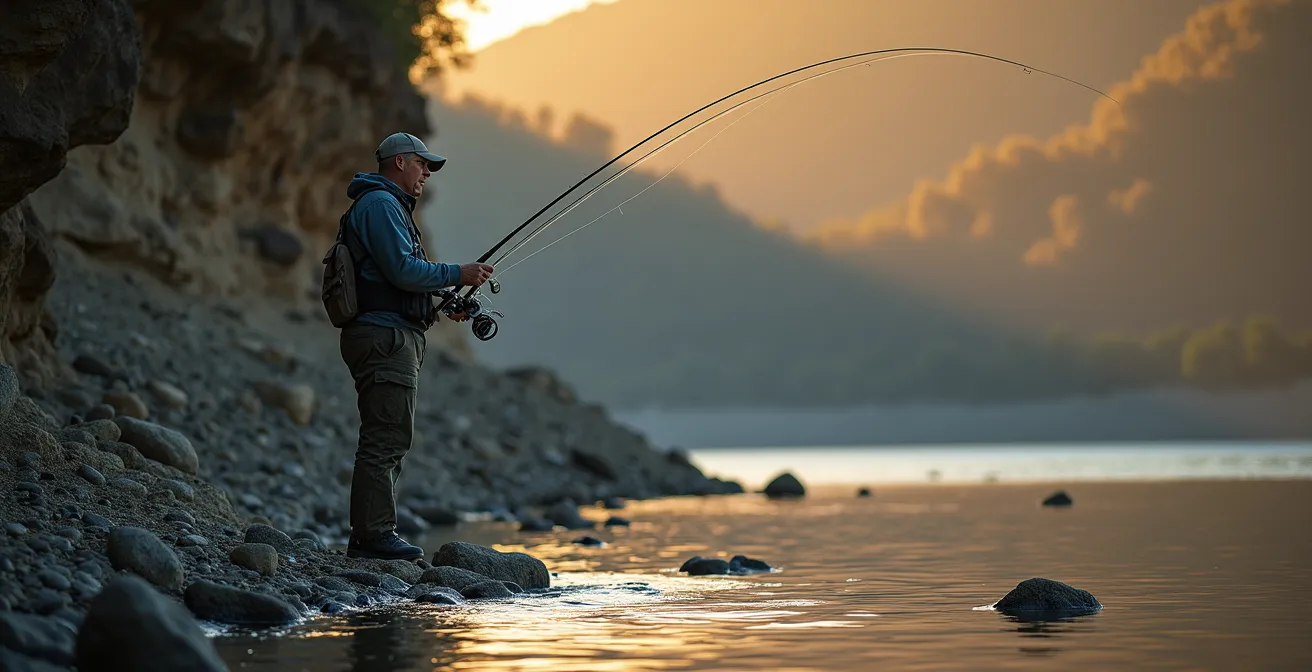
While bass suspend deep for comfort during the day, the low light of dawn triggers a feeding response. This is when they move from their deep-water sanctuaries to shallower feeding areas. Your map is the key to predicting these daily migrations. The most reliable place to find feeding bass at first light is not on the flat itself, nor in the deep water, but on the transition edge between the two. These “breaklines” are bass highways, offering a perfect combination of easy access to food and a quick escape route back to safety.
Think of shallow flats as a buffet. They are rich with baitfish, crawfish, and panfish. Drop-offs are the safe, deep-water homes. The edge where they meet is the front door to the restaurant. Bass will stage along these breaklines, using them as ambush points to attack baitfish moving up or down the water column. The tighter the contour lines on your map, the steeper the drop-off and the more defined this edge will be. These hard edges are often the most productive.

The image above illustrates this perfectly. The bass are not scattered randomly; they are positioned strategically along the breakline, where the shallow, bright flat gives way to the dark, deep water. This is their optimal hunting ground.
Case Study: Brian Snowden’s Transition Bank Strategy
Former Bassmaster Elite Series pro Brian Snowden has built a career on exploiting these transitions. He discovered that bass don’t just relate to drop-offs, they concentrate at the exact edge where a flat meets a drop-off, especially where the contour lines on a map show a distinct bend or turn toward the shoreline. According to Snowden, his most productive depth on these transition banks varies seasonally: he targets 5-15 feet in spring when bass suspend there before moving up, and a much shallower 1-5 feet in the fall as they aggressively chase baitfish onto the flats.
How to Fish Heavy Vegetation Without Fouling Your Hook Every Cast?
Vegetation is prime cover for bass, offering shade, oxygen, and ambush opportunities. However, “weeds” are not all the same, and your map can give you crucial clues about what kind of vegetation you’ll find and how to fish it. The spacing of contour lines is your first hint. Widely spaced contours suggest a gradual slope, which typically hosts sparse, low-lying grass. Tightly packed contours indicate a steep drop-off, often home to dense, vertical walls of milfoil or hydrilla. Fishing these two scenarios with the same rig is a recipe for frustration.
The key is to match your presentation to the vegetation density predicted by the map. For sparse grass on flats, a rig that can be dragged to cover water and find scattered fish is ideal. For thick, matted walls of vegetation, you need a streamlined, heavy rig that can punch through the canopy to reach the fish hiding below. Choosing the wrong setup will lead to constant snags and missed opportunities. You’re not just fishing weeds; you’re fishing a specific type of weed bed that your map helped you identify.
This table connects the map features you see to the optimal rig and weight selection, turning your map into a practical gear guide.
| Map Feature | Vegetation Type | Best Rig | Weight Range |
|---|---|---|---|
| Gradual Slope (widely spaced contours) | Sparse, low-lying | Carolina Rig | 3/4 – 1 oz |
| Sharp Drop-off (tight contours) | Dense, vertical walls | Texas Rig (punching) | 1 – 1.5 oz |
| Irregular Bottom | Mixed patches | Weedless Jig | 1/2 – 3/4 oz |
By using your map to anticipate the type of vegetation you’ll encounter, you can have the right tool tied on before you even make a cast. This proactive approach separates guides from guessers.
When Does Lake Turnover Occur and How Does It Affect Fishing Success?
Just as you get the summer pattern dialed in, nature throws a curveball: the fall turnover. This event can create some of the toughest fishing of the year if you don’t understand what’s happening. As fall air temperatures cool the lake’s surface, the warm top layer becomes denser and eventually sinks, mixing with the cold, oxygen-poor bottom layer. The thermocline that defined the bass’s world all summer disappears completely. The water becomes a uniform temperature and oxygen level from top to bottom. Suddenly, the fish are no longer confined to a specific depth band. They can be anywhere, and they often scatter.
This mixing process often makes the water murky and can even release sulfurous gases from the bottom, further disorienting the bass. Your once-reliable summer hotspots on deep structure can become barren overnight. The key to success during turnover is to recognize it’s happening and change your strategy. On your map, pay attention to the different sections of the lake. The turnover doesn’t happen everywhere at once. Shallow coves and creeks cool down faster than the deep main lake basin. In fact, studies indicate the thermocline depth can vary significantly, breaking up in 10-12 feet of water in protected coves while still holding at 25+ feet in the main lake.
During this chaotic period, bass often seek the most stable water and defined structure they can find. This is when main-lake creek channels become critical bass highways. They offer a clear path and consistent depth. Also, look for wind-protected shorelines. While one bank is getting pounded by wind and turning muddy, the opposite, calmer bank will often have clearer water and more active fish. Forget your summer spots for a week or two and focus on these transitional areas until the lake settles and the fall feeding frenzy begins.
How to Reach Deep Structures From the Bank Without a Boat?
Many anglers believe that accessing deep structure is a luxury reserved for boat owners. This is a myth. With a good topographic map and a strategic approach, bank anglers can effectively target the same deep-water haunts. The first step is a “virtual” scouting session with your map. Look for areas where deep water swings in close to the shoreline. These are your high-percentage zones. Prime examples include:
- The outside bends of creek channels: The current naturally carves out the deepest water on the outside of a turn. If that bend is near the bank, you have access.
- Bluffs and dams: These are man-made or natural steep drop-offs that offer immediate deep-water access from the shore.
- Long, tapering points: Look for points where you can walk out and cast back toward the deeper water at the end or along the sides of the point.
Once you identify these areas on the map, your on-the-water job is to make long, precise casts. Use shoreline features—a specific tree, a large rock—as reference points to triangulate your casts and systematically cover the structure. You aren’t just blindly casting; you are casting to a specific spot on an underwater ledge that you found on your map.
This approach requires more precision and patience than fishing from a boat, but the rewards can be substantial, as proven by anglers who know how to read the water from the land.
Case Study: The 12-Pound Bank-Caught Bass
A classic story among bank anglers involves an angler who noticed bass busting large minnows just beyond casting range. Instead of giving up, he consulted his map and identified a submerged weed bed that topped out within casting distance of a nearby point. By moving to that point and using shoreline landmarks to triangulate his casts, he was able to land his lure perfectly on the edge of the unseen structure. After just two jerks of his floating worm, he hooked and landed a massive 12-pound bass—a fish most boat anglers would be proud of.
Shallow vs Deep: Where Do Bass Move During a Barometric Drop?
Weather is a dynamic variable that can override typical seasonal patterns, and nothing affects bass behavior more dramatically than a change in barometric pressure. A steady, high-pressure system (bluebird skies) often pushes bass deep and makes them inactive. Conversely, a falling barometer, which precedes a storm or front, is a universal dinner bell. It triggers an instinctual feeding response, and bass that were holding deep will often move shallow, and fast.
Your map becomes a roadmap for predicting this movement. The bass won’t move to just any shallow water; they will move to the nearest shallow flat that offers good feeding opportunities. Your job is to identify the deep-water sanctuaries (main lake points, humps) and then trace the most likely travel routes to adjacent shallow flats. Look for connecting features that act as a “bass highway,” such as:
- Saddles: The low spot between two humps or a hump and a point.
- Connecting ridges or ditches: A subtle rise or dip that provides a defined path from deep to shallow.
- The inside edge of a channel bend: While the outside is deep, the inside provides a gradual slope up to a flat.
During a pressure drop, especially in the fall, these shallow flats immediately adjacent to deep water become the primary feeding zones. In fact, professional tournament data reveals that bass often move into 1-5 feet of water during these low-pressure events to capitalize on active baitfish. By anticipating this movement, you can be waiting for them in the shallows while other anglers are still searching fruitlessly in deep water.
Action Plan: Tracking Bass During Pressure Drops
- Identify Sanctuaries: Mark deep-water sanctuaries like main lake points and humps on your map.
- Trace Routes: Use contour lines to trace the most direct travel routes from these deep spots to nearby shallow flats.
- Find Corridors: Look for connecting ridges, ditches, or saddles that act as highways between deep and shallow zones.
- Mark Bottlenecks: Highlight bottlenecks like narrow gaps in ridges where fish must pass through.
- Focus on Adjacent Flats: Concentrate your fishing on shallow flats that are directly next to a deep-water escape route.
High Speed vs Low Gear Ratio: Which Reel Is Best for Crankbaits?
Your topographic map can even help you select the right gear for the job. When it comes to fishing crankbaits, the reel’s gear ratio is a critical but often overlooked variable. A high-speed reel (7.1:1 or higher) picks up line quickly, while a low gear ratio reel (5.3:1 range) is slower but provides more torque and power. Choosing the right one depends entirely on the type of structure you plan to fish, which your map will tell you.
If your map shows vast flats with widely spaced contour lines, you need to cover a lot of water to find active fish. This is where a high-speed reel excels. It allows you to “burn” a squarebill crankbait or lipless crankbait just above the bottom or over submerged vegetation, triggering reaction strikes from aggressive fish. The goal here is speed and efficiency, not power.
On the other hand, if your map shows tightly packed contour lines indicating a sharp drop-off or a deep channel ledge, you’ll be using deep-diving crankbaits. These lures have large bills that pull hard. Trying to retrieve one all day with a high-speed reel is exhausting and inefficient. A low gear ratio reel acts like a winch, giving you the power to grind that lure down to its maximum depth and keep it in the strike zone longer without wearing yourself out. It’s about power and control, not speed.
Letting the map dictate your gear ratio is a pro-level adjustment that makes your fishing far more effective and enjoyable.
| Map Feature | Reel Type | Gear Ratio | Best Application |
|---|---|---|---|
| Widely Spaced Contours (flats) | High-Speed | 7.1:1 – 8.1:1 | Burning squarebills, covering water |
| Tightly Packed Contours (drop-offs) | Low Gear | 5.3:1 – 6.3:1 | Deep diving cranks, power grinding |
| Mixed Terrain | Medium | 6.3:1 – 7.1:1 | Versatile, all-purpose cranking |
Key Takeaways
- The thermocline is an invisible “floor” in summer; nearly all bass will be at or above this depth.
- Bass use “breaklines”—the edges between flats and drop-offs—as highways for daily feeding migrations, especially at dawn.
- A map’s contour lines can predict vegetation type, allowing you to choose the right snag-proof rig before you even cast.
Texas Rig vs Carolina Rig: Which Soft Plastic Setup Is Best for Weedy Bottoms?
When fishing soft plastics around weeds and bottom structure, the Texas rig and Carolina rig are two of the most effective setups. But they are not interchangeable. Your map can, once again, be the deciding factor in which one you should tie on. The key difference lies in how each rig interacts with the bottom. The Texas rig is a stealthy, precise tool for targeting specific pieces of cover. The Carolina rig is a powerful search tool for covering broad areas and deciphering bottom composition.
When your map shows a jumble of tight contour lines mixed with symbols for stumps or rocks, this suggests a complex, snag-filled environment. This is Texas rig territory. Its streamlined, weedless design allows you to pitch or flip it into tiny pockets within thick cover, presenting the lure vertically to a specific target without getting hung up. It’s about precision.
Conversely, if your map shows a large, relatively uniform flat with widely spaced contours, suggesting a soft or sandy bottom with sparse vegetation, this is prime Carolina rig country. The heavy weight separated from the lure allows you to cast a long way and drag the rig across the bottom. This method is incredibly effective for locating fish scattered across a large area.
Case Study: The Carolina Rig as a Topographical Scanner
Many professional anglers view the Carolina rig as more than just a lure setup; it’s a real-time mapping tool. As the heavy tungsten or lead weight drags across the bottom, it transmits information up the line, allowing the angler to feel subtle changes in bottom composition. As guides and pros report, this allows them to identify transitions from soft mud to hard sand or gravel that are too subtle to appear on any printed map. In this way, the rig helps you create a more detailed “mental map” of the structure, pinpointing the hard-bottom spots where bass often congregate.
By learning to see the lake through this lens, you transform a simple map into your most powerful fishing tool. It allows you to build a reliable, repeatable game plan for any day on the water, turning frustration into confidence and long, fishless hours into tight lines.
Frequently Asked Questions on How to Read Lake Topography Maps to Find Summer Bass Hotspots?
When should I choose Texas Rig over Carolina Rig based on my map?
Use a Texas Rig when your map shows jumbled contours suggesting rocks, stumps, or thick vegetation mixed together. Its snag-proof design is perfect for making precise, vertical presentations to specific targets within that heavy cover.
What map features indicate Carolina Rig territory?
Look for large, uniform flats with widely spaced contour lines on your map. These areas typically suggest soft bottoms with sparse, scattered weeds, which is the perfect terrain for the Carolina Rig’s search-and-drag capabilities.
How do I identify weed edges on a topographic map?
Weed edges often form along distinct breaklines. On your map, look for places where the contour lines suddenly tighten up, indicating a sharp change in depth. Weeds typically grow out to this drop-off and then stop, creating a “hard edge” that bass love to use as an ambush point.